1. Activate the arccatalog from the start menu: start -> programs -> arcgis -> arccatalog (or arc using the toolbar on the catalog sheets of arc map)
2. After the active arc catalog, go to working directory (D: \ makassar)
3. Right-click on the directory , select new, click shapefile ....

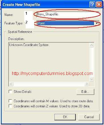
4. After dialog box appears ,
in the name box type "kecamatan", and in feature type select "polygon"
Click Edit button to determine the spatial reference


5. In the dialog box select the spatial reference properties select the button, the browse dialog box for select Coordinate system wgs 1984 Coordinate UTM zone 50S.prj, then kilk Add, click OK

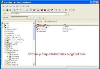
6.If you have to do the above, then the spreadsheet will appear arc catalog file: kecamatan.shp

7. You can create other shape files by using step 3 to 7

No comments:
Post a Comment