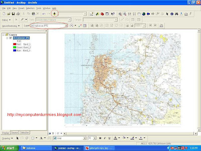
In this tutorial I use the software ArcGIS version 9.2
Raster registration procedures are: (in this exercise is a Raster data map in the data format is jpg)
1. Open the Arc GIS program from start menu -> Programs -> Arc GIS -> Arc Map

2. After the arc of the map opens, click the toolbar "+ sign" (to add a theme or Raster). After you click the toolbar "+", then a dialog box will appear and select the file you want register (in this example is used rbi_makassar.jpg). After Raster rbi_makassar appear, make sure the layer selected in the box "rbi_makassar.jpg"

3. Activate dialog box georeferencing
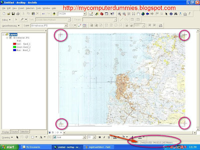
 Click a button A to determine the location of the point coordinates, and click the button B to see the value and enter the coordinates (Make registration coordinates are at least 4 point, in the corner picture). Input XMap and YMap Coordinates. After registration finish, you can save the coordinate results into a file txt format with click save button.
4. Registration results will be seen as following

It good to see ur blogs...My sister recommended this post and she was totally right keep up the fantastic work!
ReplyDeleteComputer Reformat